This trip to Shenandoah National Park was my first in almost 10 years. It was also my first time in Page County, VA in around 8 years, and my first time ever in Rappahannock County, VA. I took 825 photos in this trip, making it 5th all time in that category.
The Trip - Part One
The idea for this trip came the morning I went. It was Veterans Day, so Skyline Drive was free. I left my house around 10:15 AM, and took my first picture at 10:20 AM. Not long after, made a couple of stops before I turned west onto US 33, and headed towards Stanardsville. Just east of Stanardsville, I stopped at Peyton's on Business US 33 to get some brunch.
 |
| The park is 12 miles from Ruckersville. Skyline Drive is 15 miles away. |
I returned to the trip around 11:30 AM, and rejoined Mainline US 33 at 11:36 AM. Shortly after, I started the climb up the Blue Ridge Mountains. At 11:41 AM, I entered Shenandoah National Park, and got on the Swift Run Gap Entrance Road at 11:45 AM. I went right through the toll booth without paying, just like everyone else that day, and got greeted by a "FIRE BAN" sign, since the Quaker Run Fire was happening during this trip.
 |
| Entering Shenandoah National Park. |
 |
| I went about 30-32 miles north from Swift Run Gap. |
A few seconds later, I got on Skyline Drive for the first time in almost 10 years. I skipped the Hensley Hollow Overlook in favor of the South River Overlook, which looks down onto Greene County. At 11:55 AM, I stopped at the Baldface Mountain Overlook, which looks down onto Rockingham & Page Counties.
 |
| Looking down onto Greene County. |
 |
| Looking down onto Rockingham County. |
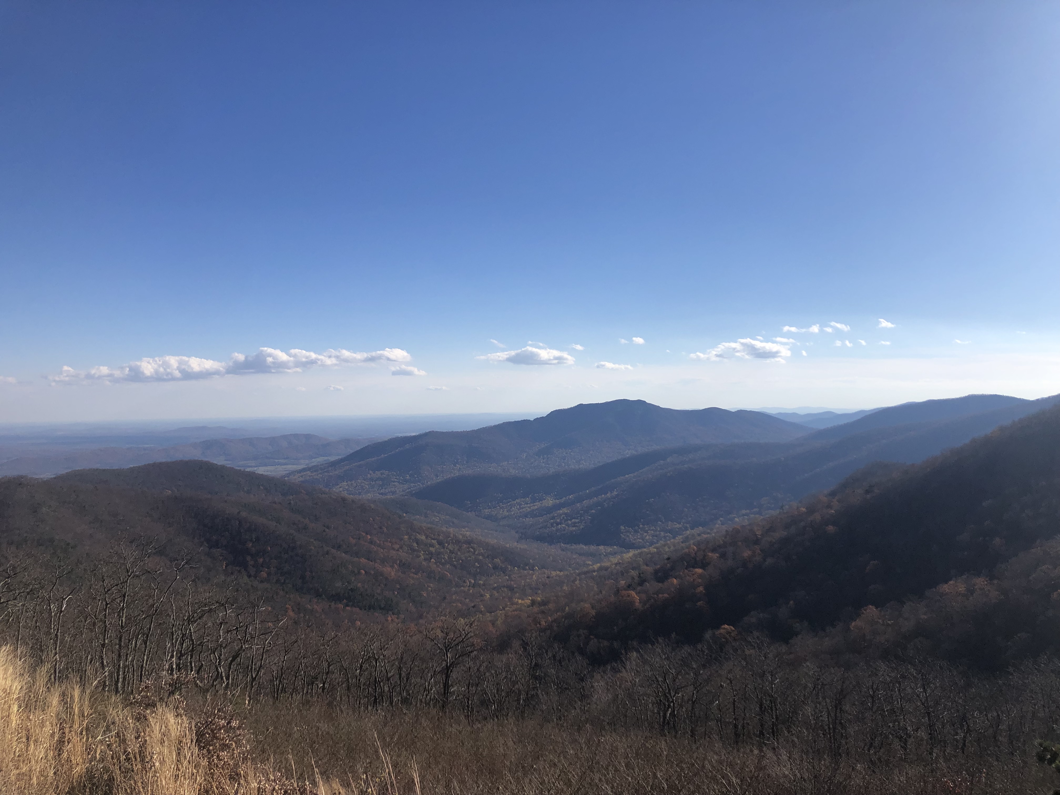
I skipped The Oaks Overlook, before entering Page County for the first time in around 8 years at 12:06 PM. I then stopped at The Point Overlook 5 minutes later, where you could see mountains well past Harrisonburg, and US 33 was visible curving around the south end of Massanutten Mountain. At 12:18 PM, I stopped at Hazeltop Ridge Overlook. I skipped Naked Creek Overlook, before stopping at Tanners Ridge Overlook, where you can view the town of Stanley. I then stopped at Big Meadows, where I got myself a nice shirt. I also took some trails in the big meadow. I would be there for an hour.
 |
| A tree is part of this Page County view. |
 |
| A big sign pointing to Big Meadows. |
 |
| 14 miles into this northbound journey. |
The Trip - Part Two
At 1:35 PM, I returned to Skyline Drive, before stopping at Fishers Gap Overlook and Franklin Cliffs Overlook. I continued north through a windy part of the road, before stopping at Spitler Knoll Overlook. At 1:58 PM, I stopped at Old Rag View Overlook, which had some great views of Madison County.
 |
| Skyline Drive with a mountain in the picture. |
 |
| Stanley and Luray are somewhere here. |
 |
| Old Rag View Overlook is stunning in person. |
At 2:07 PM, I skipped the Crescent Rock Overlook, and a minute later, I passed Skyland, followed by the highest point on Skyline Drive. At 2:12 PM, I visited Thorofare Mountain Overlook, which has some more great views of Madison County and Old Rag Mountain.
 |
| Hawksbill Mountain is the highest point in the park. |
 |
| Approaching Skyland. |
 |
| Thorofare Mountain Overlook is ahead. |
At 2:20 PM, I skipped Stony Man Mountain Overlook and Jewell Hollow Overlook, and finally entered Rappahannock County for the first time ever at 2:24 PM. To celebrate, I stopped at Pinnacles Overlook, which has the best views of Old Rag Mountain, and Madison/Rappahannock Counties.
 |
| An insanely beautiful and dangerous view. |
 |
| My first ever picture in Rappahannock County! |
 |
| The best Old Rag view. If you look really closely in the far back, you can see some of Albemarle County’s Southwest Mountains. |
I then turned around, and headed back south. I stopped at Jewell Hollow Overlook after skipping it a few minutes prior. I returned to the road at 2:43 PM, and also stopped at Stony Man Mountain Overlook. I continued south on Skyline Drive, before stopping at Spitler Knoll Overlook again at 3:07 PM.
 |
| My last picture in Rappahannock County, for now. |
 |
| An overlook sign with the view. |
 |
| An extremely amazing view featuring the sun glare. |
At 3:14 PM, I passed Big Meadows again, without stopping. I reached US 33 at 3:36 PM, skipping every overlook before the interchange. I stayed on Skyline Drive, and stopped at Swift Run Overlook. I also stopped at Sandy Bottom Overlook and Bacon Hollow Overlook. The latter has some amazing views of Greene/Albemarle Counties.
 |
| Somewhere in Madison County. |
 |
| 40 miles between US 33 and I-64 is crazy. |
 |
| Rockingham County is stunning. |
 |
| Bacon Hollow Overlook, with Greene and Albemarle Counties. |
At 3:50, I turned back around, and headed north towards Swift Run Gap. There, I went back on the connector road to leave Skyline Drive. I headed down the mountain, back into Greene County. At 4:03 PM, I officially left Shenandoah National Park. I completed my descent of the Blue Ridge Mountains shortly after. At 4:12 PM, I took my final picture of the Trip, just west of the east end of Business US 33.
 |
| Leaving Skyline Drive. |
 |
| Entering Greene County again. |
 |
| Leaving Shenandoah National Park. |
After:
I returned home not too long after, and gained a headache. I would have added the City of Charlottesville to my November 2023 counties for dinner, but decided to not go due to the headache.
I have a Shenandoah National Park T-shirt, which is cool. I was going to get a hat, but it would be almost useless once I possibly get some ??? hats.