US Route 29 is a road that goes from MD-99 in Ellicott City, MD to US 90/98 in Pensacola, FL. Since this is a Virginia based website, this page will only have the Virginia part of the route.
In Virginia, US 29 is mostly a 4-8 lane divided highway, and is a major corridor. It's also an alternative for I-81 and I-95. Parts of the route in Amherst/Nelson and Madison Counties can be very scenic.
.png) |
| US 29 Shield |
The Route Path:
US 29 enters Virginia on the Francis Scott Key Memorial Bridge. Just after entering the state, the route turns west onto Langston Blvd, with I-66 as the median. Shortly after, US 29 has a partial interchange with I-66, and goes south of the interstate. Less than a mile later, the route has another partial interchange with I-66, and continues west, north of the interstate. Shortly after, US 29 has an intersection with VA-309, followed by VA-120 right after.
After the junctions, the route still continues west for just over 2 miles, before having an indirect interchange with I-66 at an intersection with VA-237. US 29 continues southwest, entering the City of Falls Church. Shortly after, the route has an intersection with VA-7 in the middle of the city. Right after that, US 29 has an intersection with VA-338, before leaving the city, and entering Fairfax County.
The route intersects many residential streets, before passing under I-495, entering the CDP of Merrifield. US 29 continues west in the CDP, continuing to intersect residential streets, before curving southwest. The route leaves Merrifield and enters the City of Fairfax, before intersecting US 50 at an interesting roundabout with US 50 running through it.
US 29 heads west with West US 50 through the city, intersecting VA-123 after about 1.77 miles. The routes continue west, shortly before having an intersection with VA-236. Here, US 50 splits from the concurrency, and US 29 heads west back into Fairfax County.
The route passes by some Fairfax County government offices, before having an interchange with VA-286. US 29 continues to head west, intersecting SR-645 shortly before entering the CDP of Centreville. In Centreville, the route has an interchange with VA-28, followed by another one with I-66.
US 29 heads southwest, leaving the CDP, and shrinking to a 2-lane undivided highway before it enters Prince William County. The route also enters the Manassas National Battlefield Park here. After about 1.28 miles, US 29 has an intersection with VA-234, before heading through the unincorporated community of Groveton.
Shortly after, the route widens back to 4 lanes, leaving the park, and having another interchange with I-66. Just after the interchange, US 29 enters the CDP of Gainesville, having an interchange with the east end of VA-55. The route continues southwest through Gainesville, before having an intersection with US 15 along the border of the CDP.
 |
| US 29 at its interchange with VA-55. |
 |
| The north end of the US 29/15 concurrency. |
US 29/15 both continue southwest, passing through the community of Buckland, right before entering Fauquier County. Right after entering the county, the routes have an intersection with the west end of VA-215. US 29/15 still head southwest through Fauquier County, Eventually, the routes pass by the community of New Baltimore, before curving southwest.
 |
| The routes meet the west end of VA-215. |
Shortly after that, US 29/15 reach the town of Warrenton, where they have an interchange with their business routes (which lead to the east end of US 211), and US 17. The latter joins the concurrency, and they bypass the town to the east. The routes have an exit for SR-643, shortly before having another interchange with their business routes.
 |
| US 29/15 approach Warrenton. |
 |
| US 29/15/17 meet their business routes 1 mile from here. |
US 29/17/15 all continue south from Warrenton, before eventually reaching the community of Opal. Here, US 17 splits from the concurrency, leaving US 29 and US 15 to head south. After about 3.5 miles, the routes have an intersection with the southern end of VA-28, right before intersecting business routes, which serve the town of Remington. US 29/15 bypass the town to the west, before crossing the Rappahannock River, and entering Culpeper County.
 |
| US 17 splits from US 29 and US 15. |
 |
| The aftermath of the US 17 split. |
Shortly after entering the county, the routes intersect the south end of their business routes, and continue southwest through northern Culpeper County. Eventually, US 29/15 reach the CDP of Brandy Station. The routes pass by the community, before having an interchange with their third business routes as they approach the town of Culpeper. US 29/15 continue southwest, as they bypass the town to the east. They have an exit for SR-666, followed by an exit for US 522/VA-3. After that exit, the routes curve to the west, before US 15 leaves the concurrency at the next exit, where Business US 15 also meets the route.
 |
| The north end of the Culpeper business routes. |
 |
| Approaching the south end of the US 29/15 concurrency. |
US 29 continues northwest, before having an interchange with its business route, which is also the north end of VA-299, a short connector route. Leaving Culpeper, the route heads west, passing by numerous businesses as it transitions back into rural areas. Eventually, US 29 does a sharp curve to the southwest, before crossing the Crooked Run and entering Madison County.
 |
| US 29 at VA-299/Business US 29. |
 |
| The route heading west, leaving Culpeper. |
 |
| US 29 as it slowly heads for the Blue Ridge Mountains. |
 |
| Entering Madison County. |
The route passes through the small unincorporated community of Leon, before curving more to the southwest. Shortly after, US 29 enters the rural CDP of Brightwood, passing through it. After leaving the community, the route passes through the unincorporated community of Zeus, before having an intersection with its business route for the town of Madison.
 |
| At the intersections with SR-631 and SR-612. |
 |
| 5 miles north of Madison. |
 |
| US 29 at the north end of its Madison business route. |
US 29 enters the town limits as it bypasses the main area of Madison to the east. Halfway through the bypass, the route intersects SR-634, before continuing southwest. Shortly after, US 29 has an intersection with SR-687, right before Business US 29 re-intersects the mainline. With the business route, is VA-231, which joins US 29 at the intersection.
 |
| Halfway through the bypass. |
 |
| Approaching SR-687. The south end of Business US 29 is a head. |
The routes continue south from Madison for about 1.35 miles, before VA-231 splits from US 29 at an intersection with VA-230. The latter joins US 29 here, and both routes head southwest for less than a mile, before VA-230 splits back off from US 29.
 |
| US 29 and VA-231 heading south from Madison. |
 |
| US 29 replaces VA-231 with VA-230. |
 |
| US 29 and VA-230 head south with all -ville distances. |
The route continues southwest, passing through rural southern Madison County. Eventually, US 29 passes through the unincorporated community of Shelby, where it intersects SR-662. The route still continues to head southwest, before eventually crossing the Rapidan River, and entering Greene County.
 |
| Approaching Shelby. |
 |
| US 29 in its final stretch of Madison County. |
 |
| Entering Greene County. |
Shortly after entering Greene County, US 29 has an intersection with SR-609 in the unincorporated community of Burtonville. After the intersection, the route continues south, intersecting SR-645, followed by SR-633. Eventually, US 29 reaches the CDP of Ruckersville. There, the route has an intersection with US 33, before continuing south past a bunch of businesses.
 |
| At the SR-609 intersection. |
 |
| The route approaching SR-633. |
 |
| US 29 at its intersection with US 33 in Ruckersville. |
Shortly after, US 29 leaves Ruckersville, and has an intersection with SR-607. The route continues southwest from here, passing in between residental subdivisions. Shortly after, the route passes a small commercial area, and enters Albemarle County.
 |
| Heading past a suburban residental area in Greene County. |
 |
| Approaching Albemarle County. |
US 29 intersects SR-641 shortly after entering the county, and continues southwest. Eventually, the route reaches the community of Hollymead as it intersects SR-649. At the intersection, US 29 widens to 6 lanes as it passes through suburban areas. Shortly after, the route leaves Hollymead, passing through some wooded areas, before reaching another suburban area. Here, US 29 has an interchange with SR-631, as it passes by many businesses. Not long after the interchange, the route enters the City of Charlottesville.
 |
| US 29 at the SR-641 intersection. |
 |
| Entering Hollymead. |
 |
| Intersecting SR-1520 in Hollymead. |
 |
| Approaching the SR-631 intersection. |
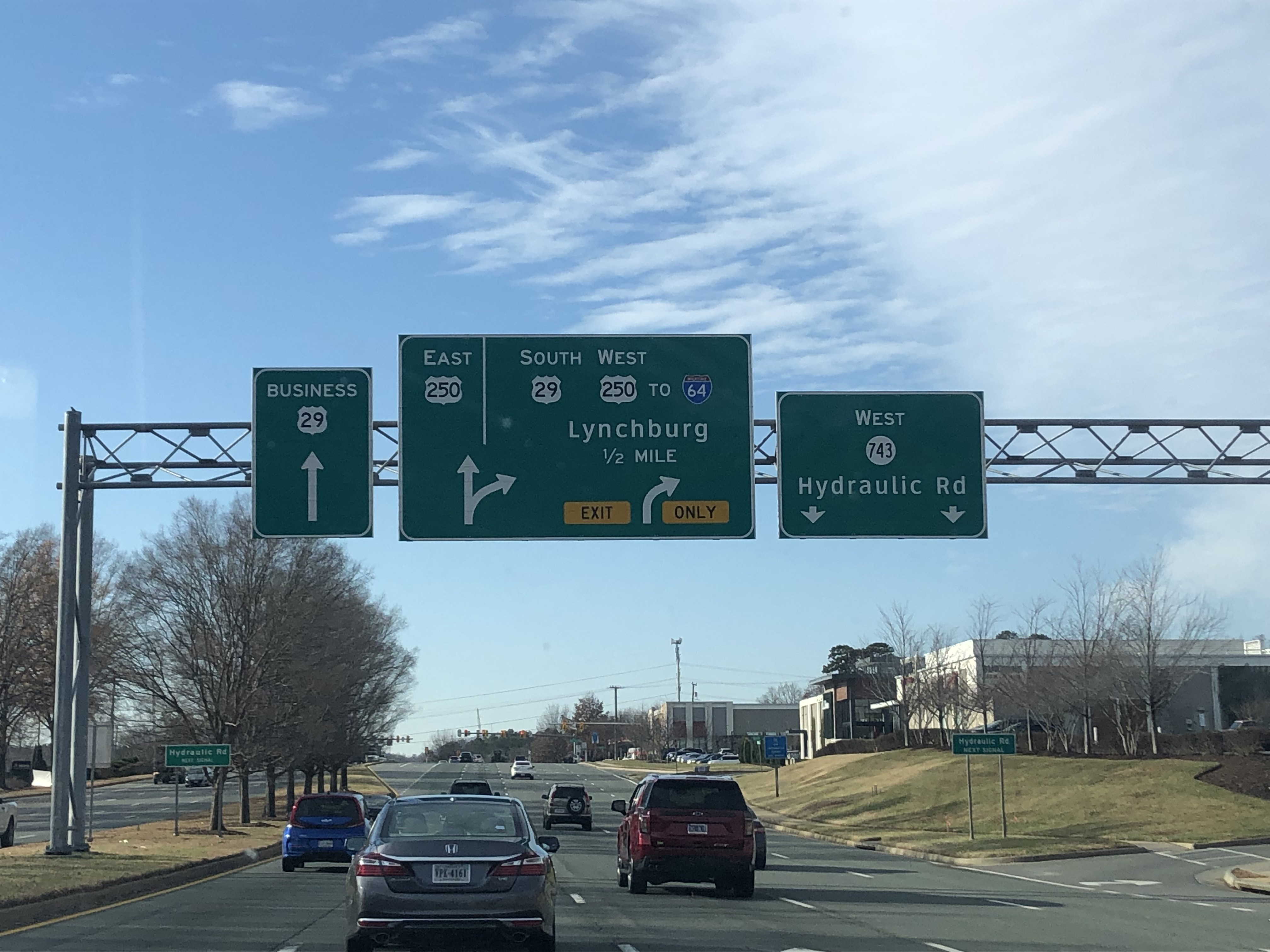
At the city limits, US 29 has an intersection with the southern end of SR-743, followed by an interchange with US 250. At the interchange, the route merges westbound onto US 250, with the road continuing south as Business US 29. US 29/250 continue west, re-entering Albemarle County, right before having an exit for SR-654.
 |
| US 29 approaching SR-743 and US 250. |
 |
| At the US 250 interchange. |
 |
| US 29/250 at the SR-654 diamond interchange. |
The routes have a northbound only exit for Leonard Sandridge Road, before having a southbound only exit for SR-601. Right after this, US 250 splits from the freeway at an interchange with its business route. US 29 continues south for just over a mile, before having an exit for Business US 29. After this, the route curves southwest, and has an interchange with I-64, where the route loses its freeway status.
 |
| US 29 approaching the US 250 split. |
 |
| US 29 at I-64. |
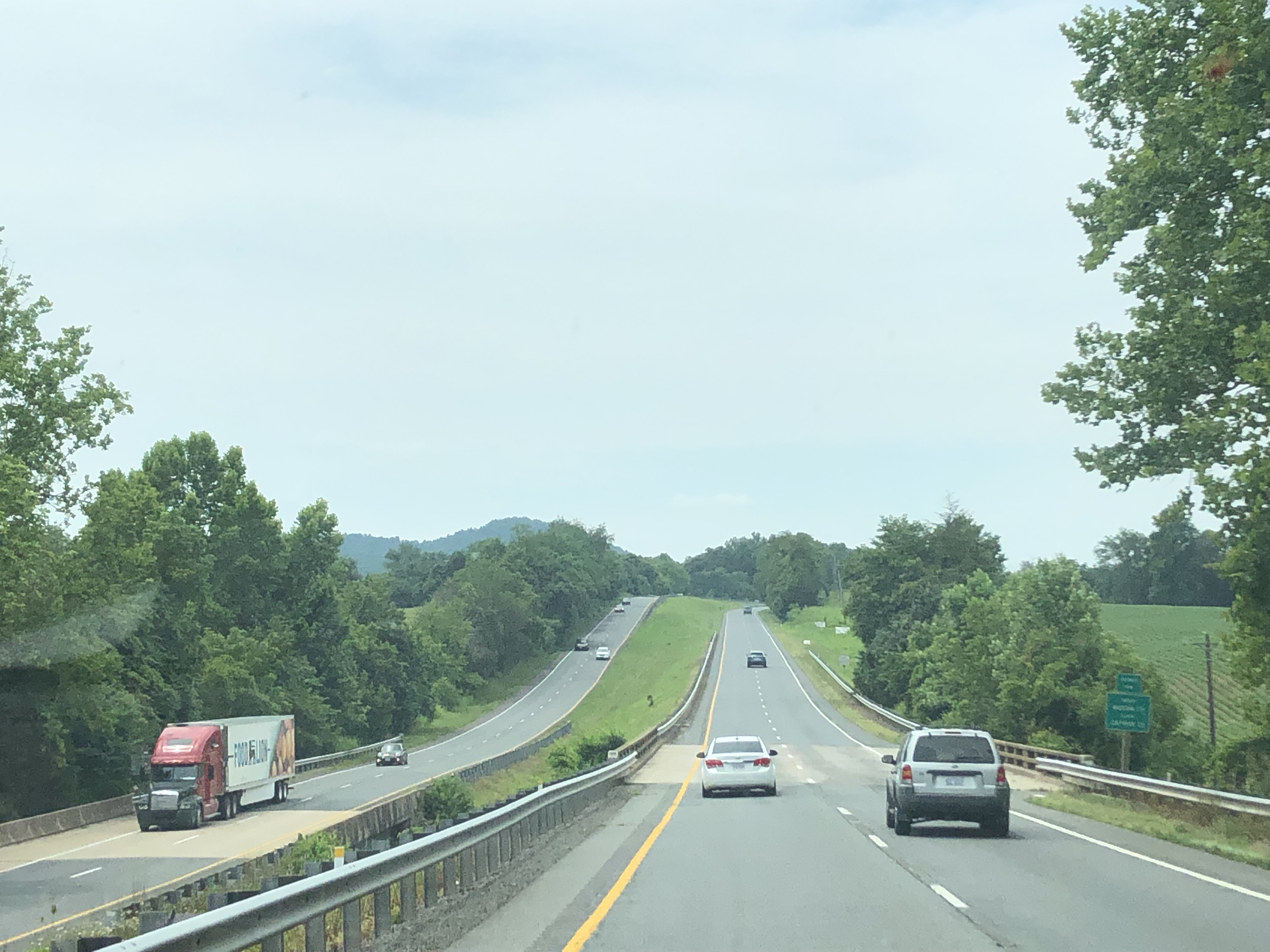
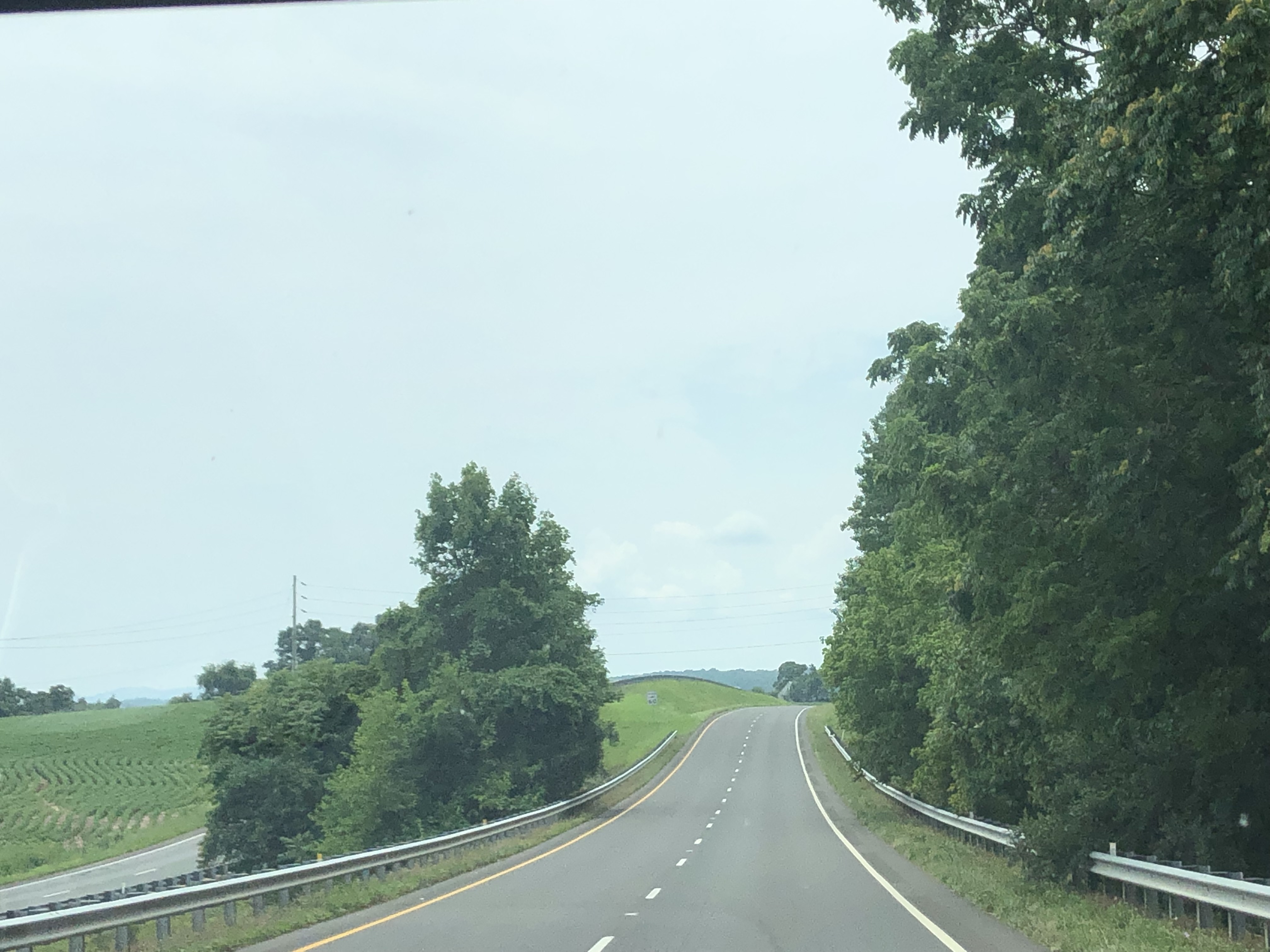
US 29 continues southwest past Charlottesville, passing through hilly terrain. Eventually, the route has an intersection with SR-708, curving west. Shortly after that, US 29 curves southwest again, before having an intersection with SR-692. The route continues southwest, still passing through hilly terrain. Eventually, US 29 passes through the community of Covesville, shortly before entering Nelson County.
 |
| Heading through southern Albemarle County. |
 |
| Approaching SR-708. |
 |
| US 29 approaching SR-692. |
Shortly after entering the county, the route has an intersection with VA-6. The state route turns onto US 29, heading west together. About 3.6 miles later, the routes intersect VA-6Y, right before crossing the Rockfish River. Just after the river crossing, VA-6 splits from the concurrency, and US 29 continues south.
 |
| US 29 at the eastern VA-6 intersection. |
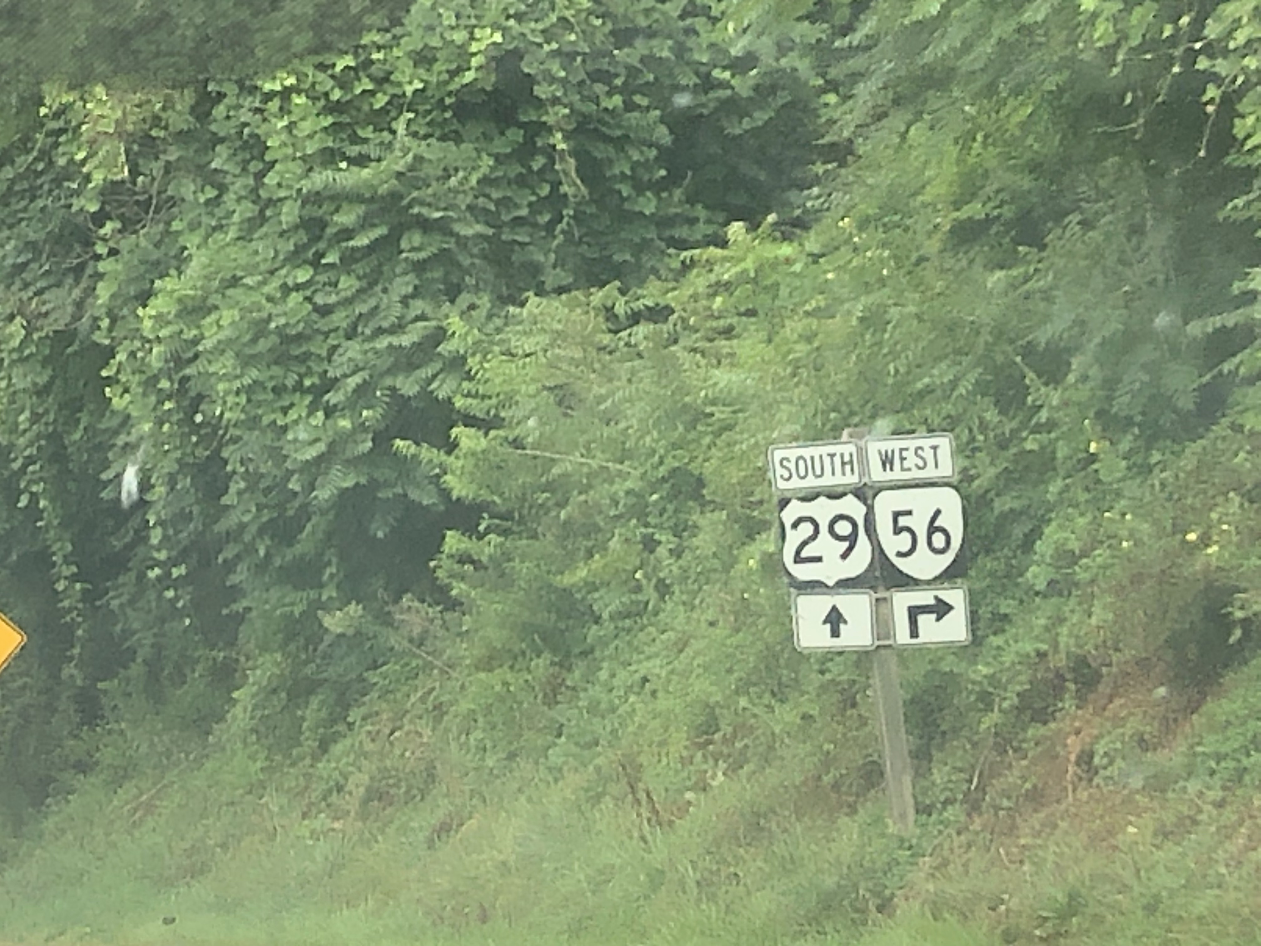
The route continues south, passing through rural, hilly Nelson County, before eventually reaching the town of Lovingston. There, US 29 intersects its business route and bypasses the town to the west. On the south end of the town, the route intersects Business US 29 again, which is now concurrent with VA-56. US 29/VA-56 both continue southwest.
 |
| Lovingston is 7 miles away from here. |
 |
| A double US 29 shield approaching Business US 29. |
 |
| Halfway through the Lovingston Bypass. |
After about 4.2 miles, VA-56 splits from the concurrency and heads west, while US 29 continues southwest through the unincorporated community of Colleen, intersecting SR-655. After leaving the community, the route continues southwest, before eventually crossing the Tye River and entering Amherst County.
 |
| US 29/VA-56 at SR-653. |
 |
| VA-56 splitting from US 29. |
 |
| US 29 at SR-655 in Colleen. |
 |
| Entering Amherst County. |
Entering the county, US 29 curves a little bit, before eventually reaching an intersection with the southern end of VA-151. Shortly after the intersection, the route has an interchange with Business US 29 as it reaches the town of Amherst. US 29 becomes a freeway as it continues south, bypassing the town to the east. Just east of downtown, the route has an interchange with US 60, before eventually having another interchange with its business route.
 |
| Approaching VA-151. |
 |
| At VA-151. |
 |
| US 29 approaching its business route for Amherst. |
US 29 continues south, still as a freeway. The route passes under SR-604 and SR-663, before passing to the east of Izaak Walton Park. After passing by the park, US 29 passes by a weigh station, before eventually entering the CDP of Madison Heights and having a diamond interchange with the east end of VA-130. The route passes under SR-622 as it leaves the CDP. Eventually after that, US 29 has an interchange with the east end of VA-210, before crossing the James River and entering the City of Lynchburg.
 |
| 15 miles away from Lynchburg. |
 |
| Approaching VA-130 (in 1 1/2 miles) |
 |
| 1 mile away from VA-210. |
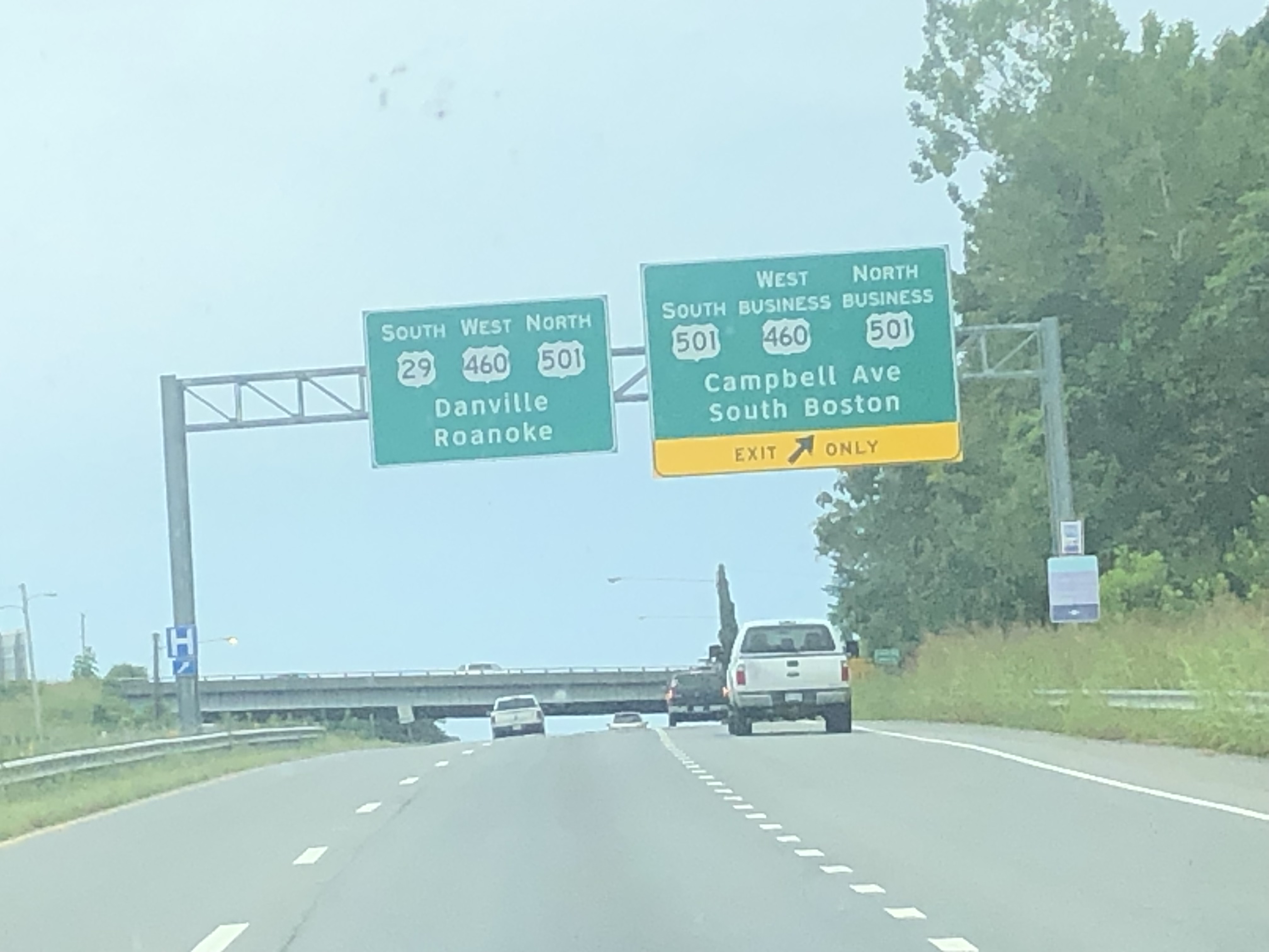
Almost immediately after entering Lynchburg, US 29 reaches an interchange with US 460. The routes both head west, having an intersection with Concord Turnpike. Eventually, the routes have an interchange with US 501/Business US 501. US 501 NB joins the concurrency, continuing southwest with US 29/460. Shortly after, the routes have a diamond interchange with Odd Fellows Road, before US 501 splits from the concurrency to head northbound. Right after the interchange, US 29/460 pass to the east of Liberty University, before US 29 splits from the concurrency at an interchange with Business US 29 on the city limits.
 |
| US 29 and US 460 are concurrent on the east side of Lynchburg. |
 |
| Approaching US 501 and Business US 460/501. |
 |
| At that exit. |
 |
| US 501 splits from the concurrency in 1 mile. |
The route continues south, now in Campbell County, as it passes by the Lynchburg Regional Airport. Eventually, US 29 has an intersection with VA-24 and continues south through rural Campbell County. intersecting many secondary routes. After about 9 miles of that, the route intersects SR-699, before crossing the Big Otter River, and having an interchange with Business US 29 as it reaches the towns of Altavista and Hurt.
 |
| At an intersection with SR-738. |
 |
| At VA-24. |
 |
| This is somewhere in Campbell County, |
The route becomes a freeway, before having an interchange with SR-711. Shortly after, US 29 has an interchange with SR-714. After that interchange, the route has another interchange, for VA-43, before eventually crossing the Roanoke River and entering Pittsylvania County.
 |
| At the SR-714 exit, coming up on VA-43. |
Right after entering the county, US 29 has a diamond interchange with SR-924, before curving south. Eventually, the route has another interchange with its business route, and continues south, passing the CDP of Motely. US 29 continues through some rural areas. Eventually, the route has an interchange with its business route as it approaches the town of Gretna, before curving southwest and becoming a freeway again. Shortly after, US 29 has a diamond interchange with VA-40, and continues south, before having another interchange with Business US 29.
 |
| At the SR-924 exit near Hurt. |
 |
| This is at SR-643 between Hurt and Gretna. |
 |
| North end of the Gretna Business US 29. |
The route continues south, passing through more rural areas as it intersects numerous secondary routes. Eventually, US 29 has a diamond interchange with its business route as it approaches the town of Chatham. Shortly after, the route has an interchange with SR-685, followed by a diamond interchange with VA-57. US 29 enters the town limits, before reuniting with its business route at a half interchange. Just after, the route leaves the town of Chatham.
 |
| At SR-649 south of Gretna. |
 |
| Approaching the Chatham Business US 29. |
 |
| Almost at the VA-57 exit on the Chatham Bypass. |
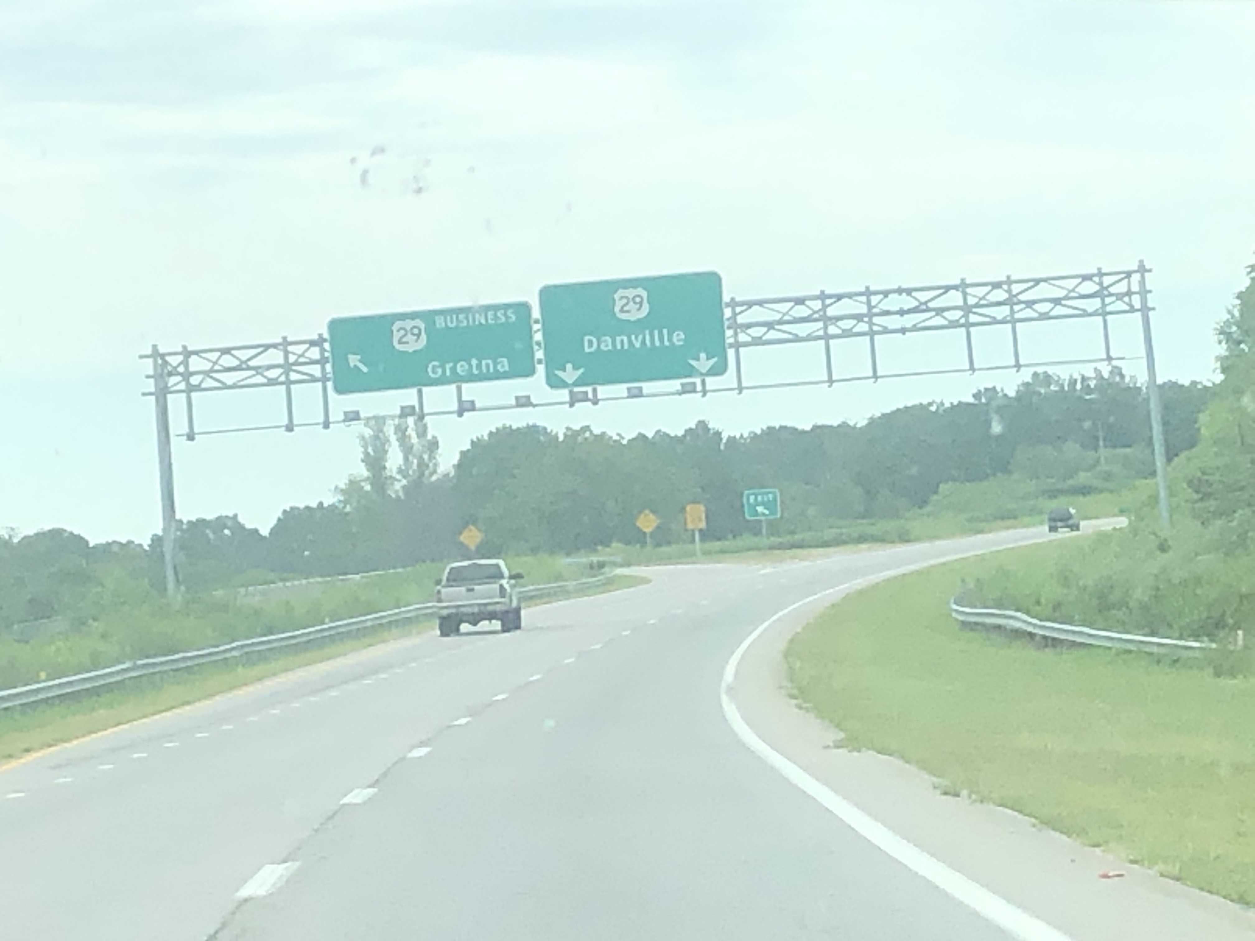
US 29 continues south, shortly before passing through the unincorporated community of Tightsqueeze. Here, the route has an intersection with SR-703, before crossing the Banister River on a pair of bridges that were formerly 3 lanes. After passing through Tightsqueeze, US 29 continues to head south through rural Pittsylvania County. Eventually, the route has an interchange with its business route (this time for Blairs/Danville) and continues south, running parallel to the business route. US 29 passes by the CDP of Blairs, before eventually having an interchange with VA-41, which ends just to the east at VA-360. Just after the interchange, the route becomes a freeway and enters the city of Danville.
 |
| At SR-703 in Tightsqueeze. |
 |
| Going over the Banister River. |
 |
| Approaching the Blairs/Danville Business US 29. |
 |
| At the VA-41 interchange. |
Shortly after entering the city, US 29 has an interchange with US 58/360. US 58 joins US 29, and both routes continue southwest, before having a diamond interchange with River Park Drive, which serves Dan Daniel Memorial Park. Just after the interchange, US 29/58 cross the Dan River, and have an interchange with SR-737. The routes continue southwest from the interchange, before eventually curving west as they have a diamond interchange with VA-86. US 29/58 continue west, running just north of the VA/NC State Line.
 |
| At the interchange for US 58/360. |
 |
| US 29/58 approaching SR-737. |
 |
| Reassurance shields for US 29/58. |
Not long after, the routes have a small exit for Elizabeth Street, followed by a south/westbound only ramp for Corning Drive. Almost immediately after, US 29/58 have an interchange with Business US 29, and Mainline US 29 leaves the concurrency, before reaching the Virginia/North Carolina State Line on the southbound exit ramp.
 |
| A distance sign. |
 |
| The exit for Elizabeth Street. |
 |
| Approaching the US 29 split. |
 |
| US 29 traffic curves left here to enter NC. |
 |
| Welcome to North Carolina. |
My Experiences:
I have been on US 29 many times, actually, almost daily nowadays. It served as a major route for me on May 18, 2023 and August 25, 2023, as well as being almost the only route I used on March 18, 2023. Just about every road trip I take that starts in my hometown involves US 29.
The following dates/trips have seen me use the route:
12/10/2022, 3/18/2023, 5/18/2023, 5/21/2023, 6/17/2023, 6/25/2023, 7/8/2023, 7/23/2023, 8/8/2023, 8/9/2023, 8/13/2023, 8/25/2023, 9/27/2023, 10/13/2023, 10/15/2023, 10/21/2023, 11/11/2023, 12/5/2023, 2/5/2024, 3/18/2024, 4/1/2024, 4/21/2024, 4/22/2024.
In other words, that's 20 out of 33 road trips with current/future pages on the Road Trips page here.
However, I haven't been on the whole route in the state. The parts I'm missing are scrambled in Northern Virginia.
.png)


